
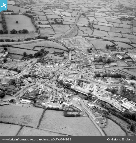
XAW044928 NORTHERN IRELAND (1952). General View, Dromore, Banbridge, Northern Ireland, 1952. Oblique aerial photograph taken facing North.
© Copyright OpenStreetMap contributors and licensed by the OpenStreetMap Foundation. 2026. Cartography is licensed as CC BY-SA.
Nearby Images (7)
XAW044928

XAW044927

XAW044929

XAW051874

XAW051873

XAW044889

XAW013344

Details
| Title | [XAW044928] General View, Dromore, Banbridge, Northern Ireland, 1952. Oblique aerial photograph taken facing North. |
| Reference | XAW044928 |
| Date | 24-July-1952 |
| Link | |
| Place name | DROMORE |
| Parish | NORTHERN IRELAND |
| District | |
| Country | NORTHERN IRELAND |
| Easting / Northing | 130868, 510120 |
| Longitude / Latitude | -6.149685, 54.415114 |
| National Grid Reference |
Pins

Drumcovitt |
Monday 27th of October 2014 01:02:18 PM | |
|
Drumcovitt |
Monday 27th of October 2014 12:58:57 PM | |
|
Drumcovitt |
Monday 27th of October 2014 12:58:22 PM |