
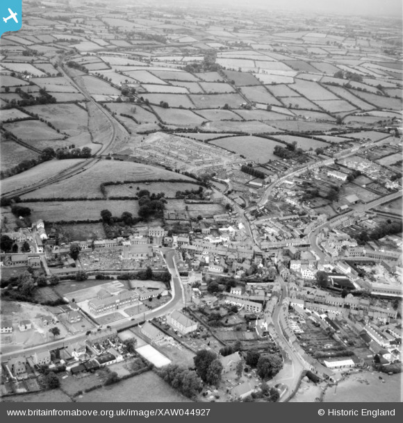
XAW044927 NORTHERN IRELAND (1952). General View, Dromore, Banbridge, Northern Ireland, 1952. Oblique aerial photograph taken facing North/East.
© Copyright OpenStreetMap contributors and licensed by the OpenStreetMap Foundation. 2026. Cartography is licensed as CC BY-SA.
Nearby Images (14)
XAW044927

XAW051874

XAW044928

XAW044929

XAW051873

XAW044889

XAW044890

XAW044883

XAW044886

XAW044885

XAW051872

XAW044887

XAW044888

XAW051877

Details
| Title | [XAW044927] General View, Dromore, Banbridge, Northern Ireland, 1952. Oblique aerial photograph taken facing North/East. |
| Reference | XAW044927 |
| Date | 24-July-1952 |
| Link | |
| Place name | DROMORE |
| Parish | NORTHERN IRELAND |
| District | |
| Country | NORTHERN IRELAND |
| Easting / Northing | 130893, 510189 |
| Longitude / Latitude | -6.149369, 54.41575 |
| National Grid Reference |
Pins

Drumcovitt |
Monday 27th of October 2014 12:55:40 PM |