
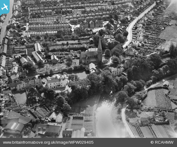
WPW029405 WALES (1929). View of Bridgend, oblique aerial view. 5"x4" black and white glass plate negative.
© Copyright OpenStreetMap contributors and licensed by the OpenStreetMap Foundation. 2026. Cartography is licensed as CC BY-SA.
Nearby Images (28)
WAW006828

WAW006829

WAW006830

WAW006831

WAW006832

WAW006833

WAW039128
. Oblique aerial photograph, 5½\" cut roll film.")
WAW039129
. Oblique aerial photograph, 5½\" cut roll film.")
WAW039130
. Oblique aerial photograph, 5½\" cut roll film.")
WAW039131

WPW008636

WPW008637

WPW008638

WPW008639

WPW008640

WPW029401

WPW029402

WPW029403

WPW029404

WPW029405

WPW029406

WPW029407

WPW029408

WPW029409

WPW029410

WPW029411

WPW038314

WPW038317

Details
| Title | [WPW029405] View of Bridgend, oblique aerial view. 5"x4" black and white glass plate negative. |
| Reference | WPW029405 |
| Date | 1929 |
| Link | Coflein Archive Item 6378038 |
| Place name | |
| Parish | |
| District | |
| Country | WALES |
| Easting / Northing | 290565, 179834 |
| Longitude / Latitude | -3.5769987719446, 51.506345252149 |
| National Grid Reference | SS906798 |
Pins

Class31 |
Wednesday 18th of September 2013 08:18:50 AM | |

Morgannus |
Friday 6th of September 2013 11:44:44 PM | |
|
Morgannus |
Friday 6th of September 2013 11:42:58 PM | |
|
Morgannus |
Friday 6th of September 2013 11:41:56 PM | |
|
Morgannus |
Friday 6th of September 2013 11:40:51 PM | |
|
Morgannus |
Friday 6th of September 2013 11:38:46 PM | |
|
Morgannus |
Friday 6th of September 2013 11:37:22 PM | |
|
Morgannus |
Friday 6th of September 2013 10:42:45 PM |