
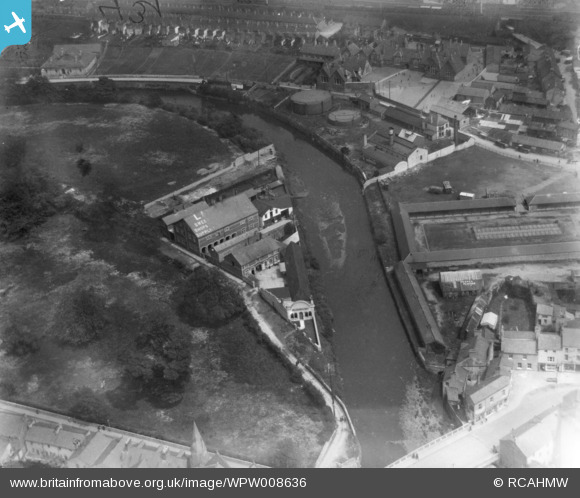
WPW008636 WALES (1923). View of Bridgend showing sweet factory, oblique aerial view. 5"x4" black and white glass plate negative.
© Copyright OpenStreetMap contributors and licensed by the OpenStreetMap Foundation. 2026. Cartography is licensed as CC BY-SA.
Nearby Images (28)
WAW006828

WAW006829

WAW006830

WAW006831

WAW006832

WAW006833

WAW039128
. Oblique aerial photograph, 5½\" cut roll film.")
WAW039129
. Oblique aerial photograph, 5½\" cut roll film.")
WAW039130
. Oblique aerial photograph, 5½\" cut roll film.")
WAW039131

WPW008636

WPW008637

WPW008638

WPW008639

WPW008640

WPW029401

WPW029402

WPW029403

WPW029404

WPW029405

WPW029406

WPW029407

WPW029408

WPW029409

WPW029410

WPW029411

WPW038314

WPW038317

Details
| Title | [WPW008636] View of Bridgend showing sweet factory, oblique aerial view. 5"x4" black and white glass plate negative. |
| Reference | WPW008636 |
| Date | 1923 |
| Link | Coflein Archive Item 6370376 |
| Place name | |
| Parish | |
| District | |
| Country | WALES |
| Easting / Northing | 290565, 179834 |
| Longitude / Latitude | -3.5769987719446, 51.506345252149 |
| National Grid Reference | SS906798 |
Pins

86F |
Monday 24th of November 2014 10:15:17 PM | |
|
Colin Ball |
Wednesday 4th of July 2012 09:06:54 PM |
User Comment Contributions
I am not sure if in fact that is the Sweet factory but across the river is certainly Pen y Bont School and the Old Gas Works. as Far as I remeber the Sweet Factory was in The Rhiw |
Edgar |
Saturday 30th of June 2012 06:31:56 PM |