
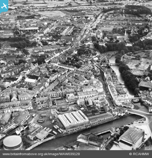
WAW039128 WALES (1951). View of Bridgend showing river and bus station (reversed). Oblique aerial photograph, 5½" cut roll film.
© Copyright OpenStreetMap contributors and licensed by the OpenStreetMap Foundation. 2026. Cartography is licensed as CC BY-SA.
Nearby Images (28)
WAW006828

WAW006829

WAW006830

WAW006831

WAW006832

WAW006833

WAW039128
. Oblique aerial photograph, 5½\" cut roll film.")
WAW039129
. Oblique aerial photograph, 5½\" cut roll film.")
WAW039130
. Oblique aerial photograph, 5½\" cut roll film.")
WAW039131

WPW008636

WPW008637

WPW008638

WPW008639

WPW008640

WPW029401

WPW029402

WPW029403

WPW029404

WPW029405

WPW029406

WPW029407

WPW029408

WPW029409

WPW029410

WPW029411

WPW038314

WPW038317

Details
| Title | [WAW039128] View of Bridgend showing river and bus station (reversed). Oblique aerial photograph, 5½" cut roll film. |
| Reference | WAW039128 |
| Date | 23-August-1951 |
| Link | Coflein Archive Item 6423103 |
| Place name | |
| Parish | |
| District | |
| Country | WALES |
| Easting / Northing | 290565, 179834 |
| Longitude / Latitude | -3.5769987719446, 51.506345252149 |
| National Grid Reference | SS906798 |
Pins
Be the first to add a comment to this image!