
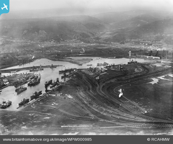
WPW000985 WALES (1920). General view of Port Talbot showing docks and steelworks, oblique aerial view. 5"x4" black and white glass plate negative.
© Copyright OpenStreetMap contributors and licensed by the OpenStreetMap Foundation. 2026. Cartography is licensed as CC BY-SA.
Nearby Images (14)
WAW005818

WAW033693

WAW033694

WAW033695

WPW000985

WPW000986

WPW000988

WPW016911

WPW016912

WPW006120

WPW006121

WPW006122

WPW029772

WPW029774

Details
| Title | [WPW000985] General view of Port Talbot showing docks and steelworks, oblique aerial view. 5"x4" black and white glass plate negative. |
| Reference | WPW000985 |
| Date | 1920 |
| Link | Coflein Archive Item 6370205 |
| Place name | |
| Parish | |
| District | |
| Country | WALES |
| Easting / Northing | 276530, 190220 |
| Longitude / Latitude | -3.7827955676634, 51.596802833336 |
| National Grid Reference | SS765902 |
Pins

Rob Preston |
Wednesday 27th of December 2017 07:59:20 AM | |
|
Keogh |
Wednesday 6th of November 2013 08:27:52 AM | |
|
Keogh |
Wednesday 6th of November 2013 08:26:16 AM | |
|
sloyne |
Thursday 17th of October 2013 04:24:07 PM | |
|
sloyne |
Friday 8th of March 2013 11:02:42 PM | |
|
sloyne |
Friday 8th of March 2013 11:01:40 PM | |
|
sloyne |
Friday 8th of March 2013 11:00:46 PM |
User Comment Contributions
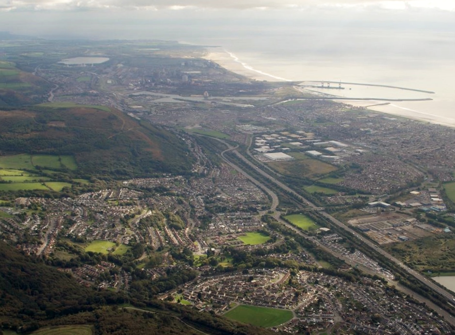
An aerial view of Port Talbot, 09/10/2013 courtesy of Con Shields. View is looking broadly south east. |

Class31 |
Thursday 30th of April 2015 06:27:28 PM |
This picture mis excellent, i love local history, many thanks to the poster. |
philmantra |
Thursday 28th of June 2012 05:13:31 PM |