
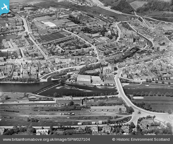
SPW027104 SCOTLAND (1929). Peebles, general view, showing Tweed Bridge, Weir and Eddlestone Water. An oblique aerial photograph taken facing north.
© Copyright OpenStreetMap contributors and licensed by the OpenStreetMap Foundation. 2026. Cartography is licensed as CC BY-SA.
Nearby Images (8)
SPW027104

SPW027099

SPW027098

SPW027101

SPW027102

SAW011531

SPW027100

SPW027110

Details
| Title | [SPW027104] Peebles, general view, showing Tweed Bridge, Weir and Eddlestone Water. An oblique aerial photograph taken facing north. |
| Reference | SPW027104 |
| Date | 1929 |
| Link | NRHE Collection item 1256623 |
| Place name | |
| Parish | PEEBLES |
| District | TWEEDDALE |
| Country | SCOTLAND |
| Easting / Northing | 325007, 640463 |
| Longitude / Latitude | -3.1918885223512, 55.651910051373 |
| National Grid Reference | NT250405 |
Pins

camphill |
Friday 14th of March 2014 01:13:34 PM | |
|
camphill |
Friday 14th of March 2014 01:12:26 PM | |
|
camphill |
Friday 14th of March 2014 01:11:10 PM |