
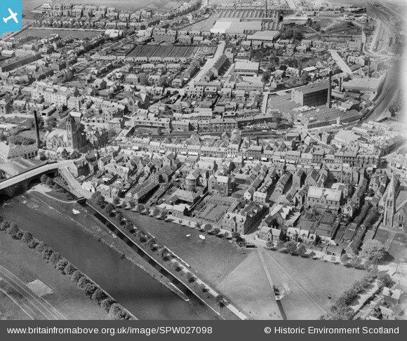
SPW027098 SCOTLAND (1929). Peebles, general view, showing High Street and Tweed Green. An oblique aerial photograph taken facing north.
© Copyright OpenStreetMap contributors and licensed by the OpenStreetMap Foundation. 2026. Cartography is licensed as CC BY-SA.
Nearby Images (7)
SPW027098

SPW027101

SPW027099

SAW011530

SPW027104

SPW027100

SPW027110

Details
| Title | [SPW027098] Peebles, general view, showing High Street and Tweed Green. An oblique aerial photograph taken facing north. |
| Reference | SPW027098 |
| Date | 1929 |
| Link | NRHE Collection item 1256617 |
| Place name | |
| Parish | PEEBLES |
| District | TWEEDDALE |
| Country | SCOTLAND |
| Easting / Northing | 325167, 640413 |
| Longitude / Latitude | -3.1893325868521, 55.651485501428 |
| National Grid Reference | NT252404 |
Pins

John Wass |
Saturday 25th of April 2015 09:28:56 PM |