
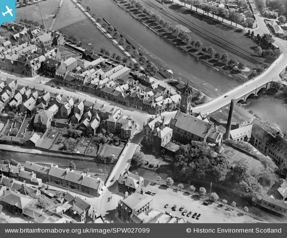
SPW027099 SCOTLAND (1929). Peebles, general view, showing Parish Church, High Street and Tweed Bridge. An oblique aerial photograph taken facing south-east.
© Copyright OpenStreetMap contributors and licensed by the OpenStreetMap Foundation. 2026. Cartography is licensed as CC BY-SA.
Nearby Images (8)
SPW027099

SPW027098

SPW027101

SPW027104

SPW027102

SPW027100

SPW027110

SAW011530

Details
| Title | [SPW027099] Peebles, general view, showing Parish Church, High Street and Tweed Bridge. An oblique aerial photograph taken facing south-east. |
| Reference | SPW027099 |
| Date | 1929 |
| Link | NRHE Collection item 1256618 |
| Place name | |
| Parish | PEEBLES |
| District | TWEEDDALE |
| Country | SCOTLAND |
| Easting / Northing | 325080, 640390 |
| Longitude / Latitude | -3.1907086854912, 55.651265456722 |
| National Grid Reference | NT251404 |
Pins
Be the first to add a comment to this image!