
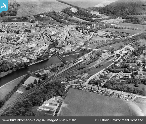
SPW027102 SCOTLAND (1929). Peebles, general view, showing Tweed Bridge, Weir and Parish Church. An oblique aerial photograph taken facing east.
© Copyright OpenStreetMap contributors and licensed by the OpenStreetMap Foundation. 2026. Cartography is licensed as CC BY-SA.
Nearby Images (4)
SPW027102

SAW011531

SPW027104

SPW027099

Details
| Title | [SPW027102] Peebles, general view, showing Tweed Bridge, Weir and Parish Church. An oblique aerial photograph taken facing east. |
| Reference | SPW027102 |
| Date | 1929 |
| Link | NRHE Collection item 1256621 |
| Place name | |
| Parish | PEEBLES |
| District | TWEEDDALE |
| Country | SCOTLAND |
| Easting / Northing | 324900, 640300 |
| Longitude / Latitude | -3.1935441444554, 55.650429084424 |
| National Grid Reference | NT249403 |
Pins

camphill |
Friday 14th of March 2014 01:06:07 PM |
User Comment Contributions
A good photo showing the general layout of the former Caley station at Peebles West. |
blandford1969 |
Tuesday 26th of June 2012 07:49:10 AM |