
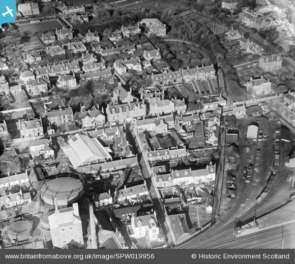
SPW019956 SCOTLAND (1927). Carnoustie, general view, showing High Street and Lochty Burn. An oblique aerial photograph taken facing north.
© Copyright OpenStreetMap contributors and licensed by the OpenStreetMap Foundation. 2026. Cartography is licensed as CC BY-SA.
Nearby Images (10)
SPW019956

SPW040482

SPW040481

SAW032105

SAW032106

SAW032107

SAW032108

SAW032109

SPW019960

SPW040484

Details
| Title | [SPW019956] Carnoustie, general view, showing High Street and Lochty Burn. An oblique aerial photograph taken facing north. |
| Reference | SPW019956 |
| Date | 1927 |
| Link | NRHE Collection item 1246358 |
| Place name | |
| Parish | BARRY |
| District | ANGUS |
| Country | SCOTLAND |
| Easting / Northing | 356471, 734617 |
| Longitude / Latitude | -2.7072038277077, 56.501717714975 |
| National Grid Reference | NO565346 |
Pins
Be the first to add a comment to this image!