
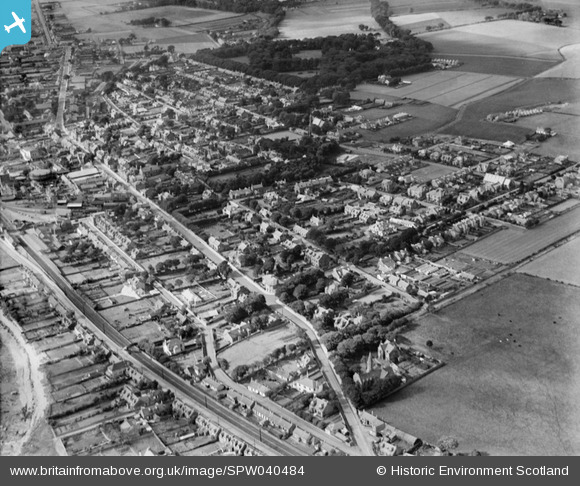
SPW040484 SCOTLAND (1932). Carnoustie, general view, showing Church Street and Carnoustie House Grounds. An oblique aerial photograph taken facing west.
© Copyright OpenStreetMap contributors and licensed by the OpenStreetMap Foundation. 2026. Cartography is licensed as CC BY-SA.
Nearby Images (8)
SPW040484

SAW032105

SAW032106

SAW032107

SAW032108

SAW032109

SPW019956

SPW040482

Details
| Title | [SPW040484] Carnoustie, general view, showing Church Street and Carnoustie House Grounds. An oblique aerial photograph taken facing west. |
| Reference | SPW040484 |
| Date | 1932 |
| Link | NRHE Collection item 1257520 |
| Place name | |
| Parish | PANBRIDE |
| District | ANGUS |
| Country | SCOTLAND |
| Easting / Northing | 356716, 734747 |
| Longitude / Latitude | -2.7032453363325, 56.502908272713 |
| National Grid Reference | NO567347 |
Pins
Be the first to add a comment to this image!