
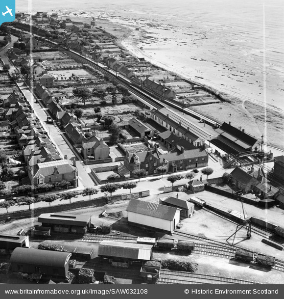
SAW032108 SCOTLAND (1950). Carnoustie, general view, showing Station Hotel, Station Road and Tayside Street. An oblique aerial photograph taken facing east. This image has been produced from a crop marked negative.
© Copyright OpenStreetMap contributors and licensed by the OpenStreetMap Foundation. 2026. Cartography is licensed as CC BY-SA.
Nearby Images (9)
SAW032105

SAW032106

SAW032107

SAW032108

SAW032109

SPW019956

SPW040482

SPW040481

SPW040484

Details
| Title | [SAW032108] Carnoustie, general view, showing Station Hotel, Station Road and Tayside Street. An oblique aerial photograph taken facing east. This image has been produced from a crop marked negative. |
| Reference | SAW032108 |
| Date | 1950 |
| Link | NRHE Collection item 1297589 |
| Place name | |
| Parish | PANBRIDE |
| District | ANGUS |
| Country | SCOTLAND |
| Easting / Northing | 356606, 734531 |
| Longitude / Latitude | -2.7049963714799, 56.50095752738 |
| National Grid Reference | NO566345 |
Pins

Matt Aldred edob.mattaldred.com |
Monday 7th of October 2024 01:59:21 PM | |

Billy Turner |
Tuesday 12th of January 2016 07:32:59 PM | |
|
Billy Turner |
Tuesday 12th of January 2016 05:26:48 PM |

