
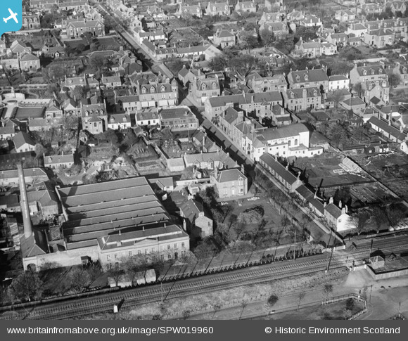
SPW019960 SCOTLAND (1927). Carnoustie, general view, showing Park Avenue and High Street. An oblique aerial photograph taken facing north.
© Copyright OpenStreetMap contributors and licensed by the OpenStreetMap Foundation. 2026. Cartography is licensed as CC BY-SA.
Nearby Images (5)
SPW019960

SPW019959

SPW040481

SPW019956

SPW040482

Details
| Title | [SPW019960] Carnoustie, general view, showing Park Avenue and High Street. An oblique aerial photograph taken facing north. |
| Reference | SPW019960 |
| Date | 1927 |
| Link | NRHE Collection item 1246362 |
| Place name | |
| Parish | BARRY |
| District | ANGUS |
| Country | SCOTLAND |
| Easting / Northing | 356300, 734490 |
| Longitude / Latitude | -2.7099604579797, 56.500560860357 |
| National Grid Reference | NO563345 |
Pins

John Wass |
Sunday 12th of September 2021 03:06:10 PM | |

Billy Turner |
Tuesday 12th of January 2016 07:22:21 PM | |
|
Farrowbee |
Sunday 29th of March 2015 11:02:08 AM |
