
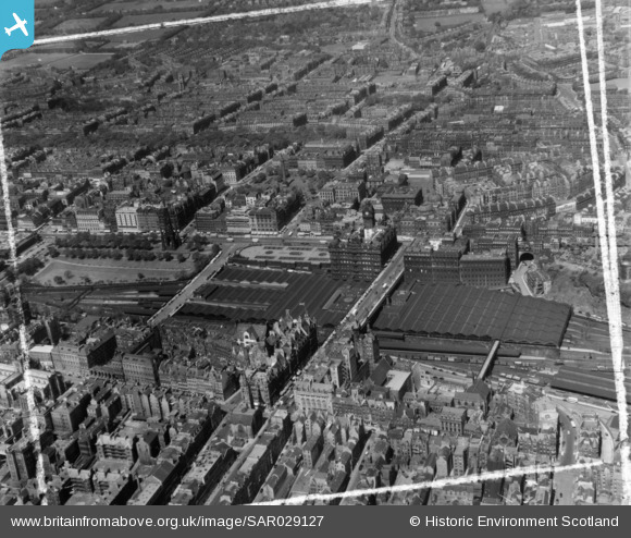
SAR029127 SCOTLAND (1957). General View Edinburgh, Midlothian, Scotland. An oblique aerial photograph taken facing North/West. This image was marked by AeroPictorial Ltd for photo editing.
© Copyright OpenStreetMap contributors and licensed by the OpenStreetMap Foundation. 2026. Cartography is licensed as CC BY-SA.
Nearby Images (24)
SAR010380

SAR029127

SAR029128

SAW014852

SAW014866

SAW014867

SAW009818

SAW010257

SPW027134

SAW009819

SAW010245

SPW027320

SPW027324

SPW027135

SAW010262

SAW010264

SPW027323

SPW027318

SAW010255

SPW027345

SPW027326

SPW027327

SAW010258

SPW027321

Details
| Title | [SAR029127] General View Edinburgh, Midlothian, Scotland. An oblique aerial photograph taken facing North/West. This image was marked by AeroPictorial Ltd for photo editing. |
| Reference | SAR029127 |
| Date | 1957 |
| Link | NRHE Collection item 1438529 |
| Place name | |
| Parish | EDINBURGH (EDINBURGH, CITY OF) |
| District | CITY OF EDINBURGH |
| Country | SCOTLAND |
| Easting / Northing | 325791, 673853 |
| Longitude / Latitude | -3.1885352354287, 55.952010097548 |
| National Grid Reference | NT258739 |
Pins

gBr |
Wednesday 19th of April 2017 11:49:51 AM |