
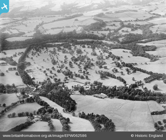
EPW062586 ENGLAND (1939). Swythamley Hall and Park, Swythamley Hall, 1939
© Copyright OpenStreetMap contributors and licensed by the OpenStreetMap Foundation. 2025. Cartography is licensed as CC BY-SA.
Nearby Images (8)
EPW062586

EPW062584

EPW062587

EPW062585

EPW062589

EPW062591

EPW062588

EPW062590

Details
| Title | [EPW062586] Swythamley Hall and Park, Swythamley Hall, 1939 |
| Reference | EPW062586 |
| Date | 10-August-1939 |
| Link | |
| Place name | SWYTHAMLEY HALL |
| Parish | HEATON |
| District | |
| Country | ENGLAND |
| Easting / Northing | 397118, 364689 |
| Longitude / Latitude | -2.043126904491, 53.179008639414 |
| National Grid Reference | SJ971647 |
