
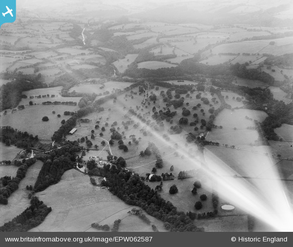
EPW062587 ENGLAND (1939). Swythamley Park, Swythamley Hall, 1939. This image has been affected by flare.
© Copyright OpenStreetMap contributors and licensed by the OpenStreetMap Foundation. 2025. Cartography is licensed as CC BY-SA.
Nearby Images (4)
EPW062587

EPW062586

EPW062585

EPW062584

Details
| Title | [EPW062587] Swythamley Park, Swythamley Hall, 1939. This image has been affected by flare. |
| Reference | EPW062587 |
| Date | 10-August-1939 |
| Link | |
| Place name | SWYTHAMLEY HALL |
| Parish | HEATON |
| District | |
| Country | ENGLAND |
| Easting / Northing | 397007, 364619 |
| Longitude / Latitude | -2.0447872777644, 53.178378730468 |
| National Grid Reference | SJ970646 |
