
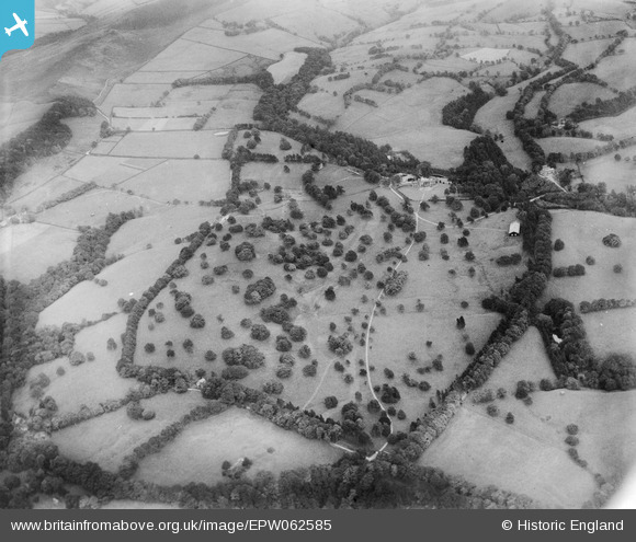
EPW062585 ENGLAND (1939). Swythamley Park, Swythamley Hall, 1939
© Copyright OpenStreetMap contributors and licensed by the OpenStreetMap Foundation. 2025. Cartography is licensed as CC BY-SA.
Nearby Images (5)
EPW062585

EPW062587

EPW062586

EPW062584

EPW062583

Details
| Title | [EPW062585] Swythamley Park, Swythamley Hall, 1939 |
| Reference | EPW062585 |
| Date | 10-August-1939 |
| Link | |
| Place name | SWYTHAMLEY HALL |
| Parish | HEATON |
| District | |
| Country | ENGLAND |
| Easting / Northing | 396949, 364755 |
| Longitude / Latitude | -2.0456564881432, 53.179601033364 |
| National Grid Reference | SJ969648 |
Pins
User Comment Contributions
Situated about six miles south east of Macclesfield. The main path running from the entrance porch is running almost directly to the West, so in this image we are looking to the East |

totoro |
Wednesday 4th of September 2013 09:31:22 AM |