
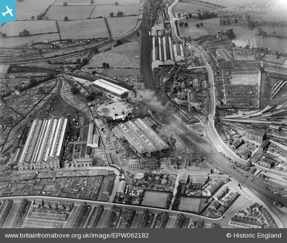
EPW062182 ENGLAND (1939). The Whessoe Engineering Foundry, Darlington, 1939
© Copyright OpenStreetMap contributors and licensed by the OpenStreetMap Foundation. 2026. Cartography is licensed as CC BY-SA.
Nearby Images (25)
EPW062182

EAW019727

EAW019728

EPW031543

EPW031545

EPW031540

EPW062173

EPW031541

EPW062183

EPW031542

EPW062184

EAW019726A

EAW019729

EPW031539

EPW031544

EAW019720

EAW019723

EAW019726

EAW019721

EAW019722

EPW029509

EPW062179

EAW019725

EAW019724

EAW019719

Details
| Title | [EPW062182] The Whessoe Engineering Foundry, Darlington, 1939 |
| Reference | EPW062182 |
| Date | 10-July-1939 |
| Link | |
| Place name | DARLINGTON |
| Parish | |
| District | |
| Country | ENGLAND |
| Easting / Northing | 428543, 516100 |
| Longitude / Latitude | -1.5587932546232, 54.53923355058 |
| National Grid Reference | NZ285161 |

