
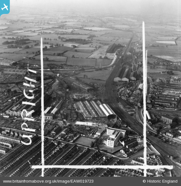
EAW019723 ENGLAND (1948). The Whessoe Engineering Works and environs, Darlington, 1948. This image has been produced from a print marked by Aerofilms Ltd for photo editing.
© Copyright OpenStreetMap contributors and licensed by the OpenStreetMap Foundation. 2026. Cartography is licensed as CC BY-SA.
Nearby Images (23)
EAW019723

EAW019729

EPW062184

EPW031543

EPW031545

EPW031542

EPW031541

EPW031540

EPW031539

EPW062182

EAW019726A

EAW019727

EAW019722

EAW019728

EAW019721

EPW062173

EPW062183

EAW019720

EPW031544

EAW019726

EPW062178

EPW029509

EPW062181

Details
| Title | [EAW019723] The Whessoe Engineering Works and environs, Darlington, 1948. This image has been produced from a print marked by Aerofilms Ltd for photo editing. |
| Reference | EAW019723 |
| Date | 6-October-1948 |
| Link | |
| Place name | DARLINGTON |
| Parish | |
| District | |
| Country | ENGLAND |
| Easting / Northing | 428493, 516190 |
| Longitude / Latitude | -1.5595573995233, 54.540045254132 |
| National Grid Reference | NZ285162 |
