
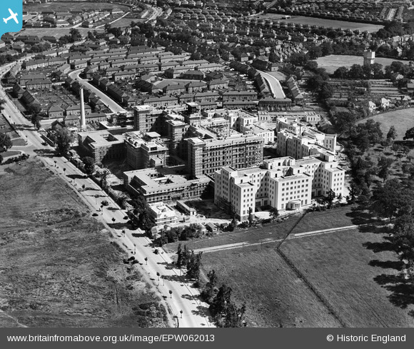
EPW062013 ENGLAND (1939). St Helier Hospital under construction, St Helier, 1939
© Copyright OpenStreetMap contributors and licensed by the OpenStreetMap Foundation. 2026. Cartography is licensed as CC BY-SA.
Nearby Images (15)
EPW062013

EAW018360

EPW062014

EAW018364

EAW018362

EPW062012

EPW062018

EPW062017

EPW062016

EAW018359

EPW062015

EAW018361

EAW018357

EAW018363

EAW018358

Details
| Title | [EPW062013] St Helier Hospital under construction, St Helier, 1939 |
| Reference | EPW062013 |
| Date | 27-June-1939 |
| Link | |
| Place name | ST HELIER |
| Parish | |
| District | |
| Country | ENGLAND |
| Easting / Northing | 526440, 166160 |
| Longitude / Latitude | -0.18296241621981, 51.379893137927 |
| National Grid Reference | TQ264662 |
Pins
Be the first to add a comment to this image!