
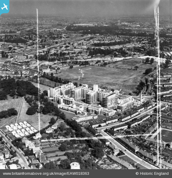
EAW018363 ENGLAND (1948). St Helier Hospital and environs, St Helier, from the south, 1948. This image has been produced from a print marked by Aerofilms Ltd for photo editing.
© Copyright OpenStreetMap contributors and licensed by the OpenStreetMap Foundation. 2026. Cartography is licensed as CC BY-SA.
Nearby Images (15)
EAW018363

EAW018357

EAW018361

EPW062015

EPW062017

EPW062018

EAW018359

EPW062012

EPW062016

EAW018362

EPW062014

EAW018360

EPW062013

EAW018364

EAW018358

Details
| Title | [EAW018363] St Helier Hospital and environs, St Helier, from the south, 1948. This image has been produced from a print marked by Aerofilms Ltd for photo editing. |
| Reference | EAW018363 |
| Date | 27-August-1948 |
| Link | |
| Place name | ST HELIER |
| Parish | |
| District | |
| Country | ENGLAND |
| Easting / Northing | 526481, 166020 |
| Longitude / Latitude | -0.18242338833719, 51.378625659559 |
| National Grid Reference | TQ265660 |
Pins

Post-war prefabs |
Sunday 18th of April 2021 12:56:00 PM | |
|
christhewino |
Sunday 31st of August 2014 10:11:46 PM | |
|
christhewino |
Sunday 31st of August 2014 10:07:58 PM |