
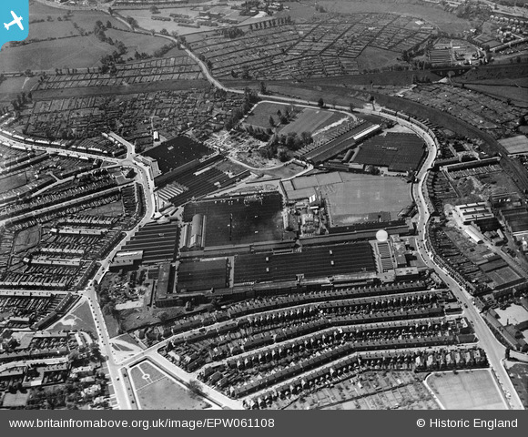
EPW061108 ENGLAND (1939). The Humber Motor Car Works, Lower Stoke, 1939
© Copyright OpenStreetMap contributors and licensed by the OpenStreetMap Foundation. 2026. Cartography is licensed as CC BY-SA.
Nearby Images (16)
EPW061108

EPW010514

EPW010574

EPW027053

EPW027054

EPW027051

EPW027049

EPW010515

EPW027055

EPW027056

EPW027050

EPW021025

EPW027052

EPW021024

EPW021022

EPW021023

Details
| Title | [EPW061108] The Humber Motor Car Works, Lower Stoke, 1939 |
| Reference | EPW061108 |
| Date | 30-May-1939 |
| Link | |
| Place name | LOWER STOKE |
| Parish | |
| District | |
| Country | ENGLAND |
| Easting / Northing | 435195, 278150 |
| Longitude / Latitude | -1.4826579981128, 52.399852507797 |
| National Grid Reference | SP352782 |
Pins

Darren |
Saturday 20th of April 2019 02:49:14 AM | |
|
tom ryan |
Friday 11th of December 2015 03:35:35 AM | |
|
tom ryan |
Friday 11th of December 2015 03:34:17 AM | |
|
andydavies |
Friday 6th of June 2014 07:23:24 PM | |
|
andydavies |
Friday 6th of June 2014 07:22:37 PM | |
|
andydavies |
Friday 6th of June 2014 07:20:39 PM |