
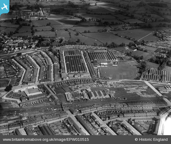
EPW010515 ENGLAND (1924). The Humber Works, Coventry, 1924
© Copyright OpenStreetMap contributors and licensed by the OpenStreetMap Foundation. 2026. Cartography is licensed as CC BY-SA.
Nearby Images (25)
EPW010515

EPW027055

EPW027050

EPW027054

EPW027056

EPW027049

EPW027051

EPW027052

EPW027053

EPW010574

EPW010514

EAW030222

EPW061110

EAW030217

EAW030218

EPW061108

EAW030221

EAW030220

EAW030223

EAW030214

EAW030216

EAW030219

EAW030215

EPW027044

EPW027046

Details
| Title | [EPW010515] The Humber Works, Coventry, 1924 |
| Reference | EPW010515 |
| Date | 28-May-1924 |
| Link | |
| Place name | COVENTRY |
| Parish | |
| District | |
| Country | ENGLAND |
| Easting / Northing | 435086, 278320 |
| Longitude / Latitude | -1.484242329957, 52.401387937712 |
| National Grid Reference | SP351783 |
Pins

Matt |
Sunday 24th of August 2025 03:14:05 PM |