
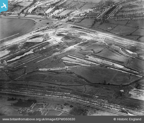
EPW060630 ENGLAND (1939). Lea Valley Road and the William Girling Reservoir under construction, Enfield, 1939
© Copyright OpenStreetMap contributors and licensed by the OpenStreetMap Foundation. 2026. Cartography is licensed as CC BY-SA.
Nearby Images (25)
EPW060630

EPW058456
 Reservoir under construction, Edmonton, 1938")
EPW053846
 Reservoir under construction, Edmonton, 1937")
EPW049524

EAW040926

EPW052278

EPW056811

EPW060220
 Reservoir under construction, Edmonton, 1938")
EPW052266

EPW053842
 Reservoir under construction, Edmonton, 1937. This image has been affected by flare.")
EAW040925

EPW049718

EPW050861

EPW052689

EAW040928

EPW060639

EPW049705

EPW053845
 Reservoir under construction, Edmonton, 1937")
EPW052277

EPW053849
 Reservoir under construction, Edmonton, 1937")
EPW055971

EPW050866

EPW056826

EPW056331

EPW058464
 Reservoir under construction, Edmonton, 1938")
Details
| Title | [EPW060630] Lea Valley Road and the William Girling Reservoir under construction, Enfield, 1939 |
| Reference | EPW060630 |
| Date | 2-March-1939 |
| Link | |
| Place name | ENFIELD |
| Parish | |
| District | |
| Country | ENGLAND |
| Easting / Northing | 536876, 194758 |
| Longitude / Latitude | -0.021979168263379, 51.634487312356 |
| National Grid Reference | TQ369948 |
Pins
Be the first to add a comment to this image!