
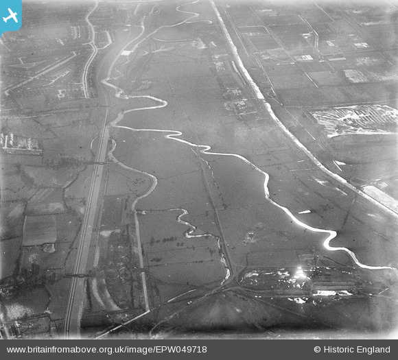
EPW049718 ENGLAND (1936). The site of the William Girling Reservoir showing preliminary construction works, Edmonton, from the north, 1936
© Copyright OpenStreetMap contributors and licensed by the OpenStreetMap Foundation. 2026. Cartography is licensed as CC BY-SA.
Nearby Images (19)
EPW049718

EPW060639

EAW040925

EAW040928

EPW055971

EPW053846
 Reservoir under construction, Edmonton, 1937")
EPW049524

EPW060630

EPW058456
 Reservoir under construction, Edmonton, 1938")
EPW060222
 Reservoir under construction, Edmonton, 1938")
EPW049716

EPW058464
 Reservoir under construction, Edmonton, 1938")
EPW058462
 Reservoir under construction, Edmonton, 1938")
EPW056811

EAW040926

EPW053854
 Reservoir under construction, Edmonton, 1937")
EPW052278

EPW055976

EPW056813

Details
| Title | [EPW049718] The site of the William Girling Reservoir showing preliminary construction works, Edmonton, from the north, 1936 |
| Reference | EPW049718 |
| Date | March-1936 |
| Link | |
| Place name | EDMONTON |
| Parish | |
| District | |
| Country | ENGLAND |
| Easting / Northing | 536971, 194607 |
| Longitude / Latitude | -0.020666278289112, 51.633107158738 |
| National Grid Reference | TQ370946 |
Pins
Be the first to add a comment to this image!