
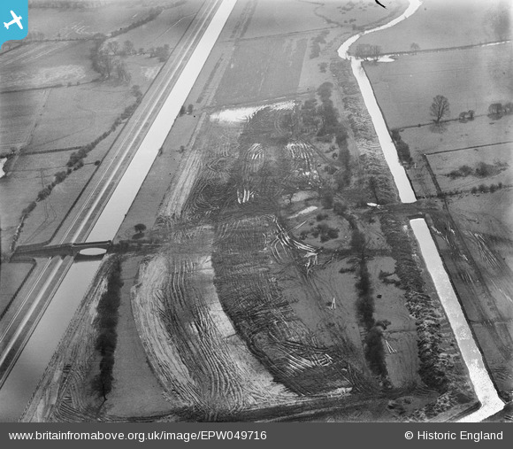
EPW049716 ENGLAND (1936). The site of the northern end of the William Girling Reservoir showing preliminary construction works, Ponders End, 1936
© Copyright OpenStreetMap contributors and licensed by the OpenStreetMap Foundation. 2026. Cartography is licensed as CC BY-SA.
Nearby Images (11)
EPW049716

EAW040928

EAW040925

EAW040929

EPW049718

EPW049698

EPW049524

EPW049522

EPW060639

EPW052689

EPW055971

Details
| Title | [EPW049716] The site of the northern end of the William Girling Reservoir showing preliminary construction works, Ponders End, 1936 |
| Reference | EPW049716 |
| Date | March-1936 |
| Link | |
| Place name | PONDERS END |
| Parish | |
| District | |
| Country | ENGLAND |
| Easting / Northing | 537159, 194695 |
| Longitude / Latitude | -0.017916803252922, 51.633852195167 |
| National Grid Reference | TQ372947 |
Pins
Be the first to add a comment to this image!