
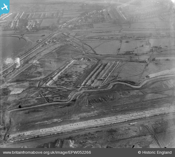
EPW052266 ENGLAND (1936). The site of the northern end of the William Girling Reservoir showing preliminary construction works, Ponders End, 1936
© Copyright OpenStreetMap contributors and licensed by the OpenStreetMap Foundation. 2026. Cartography is licensed as CC BY-SA.
Nearby Images (33)
EPW052266

EPW060220
 Reservoir under construction, Edmonton, 1938")
EPW050861

EPW053845
 Reservoir under construction, Edmonton, 1937")
EPW052278

EPW053849
 Reservoir under construction, Edmonton, 1937")
EAW040926

EPW056811

EPW049705

EPW053842
 Reservoir under construction, Edmonton, 1937. This image has been affected by flare.")
EPW056330

EPW060630

EPW058456
 Reservoir under construction, Edmonton, 1938")
EPW060224
 Reservoir under construction, Edmonton, from the north, 1938")
EPW055975

EPW060638

EPW050867

EPW049524

EPW053846
 Reservoir under construction, Edmonton, 1937")
EPW052689

EPW049694

EPW056826

EPW055978

EPW060626

EPW049695

EPW052275

EPW053850
 Reservoir under construction, Edmonton, 1937")
EPW053839
 Reservoir under construction, Edmonton, 1937")
EPW049719

EPW058469
 Reservoir under construction, Edmonton, 1938")
EPW055986

EPW048905

EPW050860

Details
| Title | [EPW052266] The site of the northern end of the William Girling Reservoir showing preliminary construction works, Ponders End, 1936 |
| Reference | EPW052266 |
| Date | November-1936 |
| Link | |
| Place name | PONDERS END |
| Parish | |
| District | |
| Country | ENGLAND |
| Easting / Northing | 536762, 194879 |
| Longitude / Latitude | -0.023578265457787, 51.63560246402 |
| National Grid Reference | TQ368949 |
Pins
Be the first to add a comment to this image!