
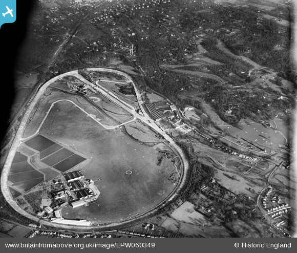
EPW060349 ENGLAND (1939). Brooklands Motor Course and environs, Brooklands, 1939
© Copyright OpenStreetMap contributors and licensed by the OpenStreetMap Foundation. 2026. Cartography is licensed as CC BY-SA.
Nearby Images (22)
EPW060349

EPW060342

EPW056376
 Ltd Works, Brooklands, from the north-west, 1938")
EPW056374
 Ltd Works, Brooklands, 1938")
EPW016860

EPW056377
 Ltd Works, Brooklands, 1938")
EPW060347

EPW060343

EPW056378
 Ltd Works, Brooklands, 1938")
EPW056375
 Ltd Works, Brooklands, 1938")
EPW060345

EPW056380
 Ltd Works, Brooklands, 1938. This image has been produced from a copy-negative.")
EPW028332

EPW056379
 Ltd Works, Brooklands, 1938. This image has been produced from a damaged negative.")
EPW060346

EPW060344

EPW056381
 Ltd Works, Brooklands, 1938. This image has been produced from a damaged negative.")
EPW060350

EPW056382
 Ltd Works, Brooklands, 1938. This image has been produced from a damaged negative.")
EPW056386
 Ltd Works, Brooklands, 1938. This image has been produced from a damaged negative.")
EPW056384
 Ltd Works, Brooklands, 1938. This image has been produced from a damaged negative.")
EPW056385
 Ltd Works, Brooklands, 1938. This image has been produced from a damaged negative.")
Details
| Title | [EPW060349] Brooklands Motor Course and environs, Brooklands, 1939 |
| Reference | EPW060349 |
| Date | 12-January-1939 |
| Link | |
| Place name | BROOKLANDS |
| Parish | |
| District | |
| Country | ENGLAND |
| Easting / Northing | 507047, 162217 |
| Longitude / Latitude | -0.46272418297322, 51.348437070088 |
| National Grid Reference | TQ070622 |
Pins

Class31 |
Wednesday 26th of February 2014 11:32:43 AM | |
|
Class31 |
Wednesday 26th of February 2014 11:20:37 AM | |
|
Class31 |
Wednesday 26th of February 2014 11:01:04 AM | |
|
Class31 |
Wednesday 26th of February 2014 10:54:49 AM | |
|
Class31 |
Wednesday 26th of February 2014 10:54:30 AM |