
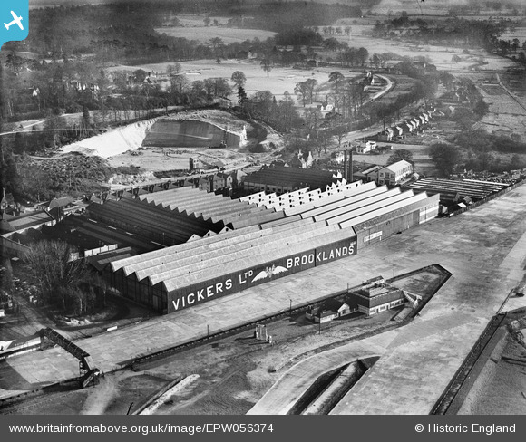
EPW056374 ENGLAND (1938). Vickers (Aviation) Ltd Works, Brooklands, 1938
© Copyright OpenStreetMap contributors and licensed by the OpenStreetMap Foundation. 2026. Cartography is licensed as CC BY-SA.
Nearby Images (19)
EPW056374
 Ltd Works, Brooklands, 1938")
EPW056377
 Ltd Works, Brooklands, 1938")
EPW060343

EPW016860

EPW060342

EPW060345

EPW060346

EPW056380
 Ltd Works, Brooklands, 1938. This image has been produced from a copy-negative.")
EPW056375
 Ltd Works, Brooklands, 1938")
EPW056378
 Ltd Works, Brooklands, 1938")
EPW056376
 Ltd Works, Brooklands, from the north-west, 1938")
EPW056379
 Ltd Works, Brooklands, 1938. This image has been produced from a damaged negative.")
EPW060349

EPW056381
 Ltd Works, Brooklands, 1938. This image has been produced from a damaged negative.")
EPW056382
 Ltd Works, Brooklands, 1938. This image has been produced from a damaged negative.")
EPW060347

EPW060344

EPW056383
 Ltd Works, Brooklands, 1938. This image has been produced from a damaged negative.")
EPW028332

Details
| Title | [EPW056374] Vickers (Aviation) Ltd Works, Brooklands, 1938 |
| Reference | EPW056374 |
| Date | 2-March-1938 |
| Link | |
| Place name | BROOKLANDS |
| Parish | |
| District | |
| Country | ENGLAND |
| Easting / Northing | 507161, 162254 |
| Longitude / Latitude | -0.46107654670455, 51.34874819149 |
| National Grid Reference | TQ072623 |
Pins

Class31 |
Wednesday 26th of February 2014 11:50:33 AM |
User Comment Contributions
On the opposite side of the road is the sand pit. By 1940 ten tunnels had been bored in to the foot of the cliff and were used as air raid shelters |

Leo |
Friday 27th of December 2013 06:27:06 PM |