
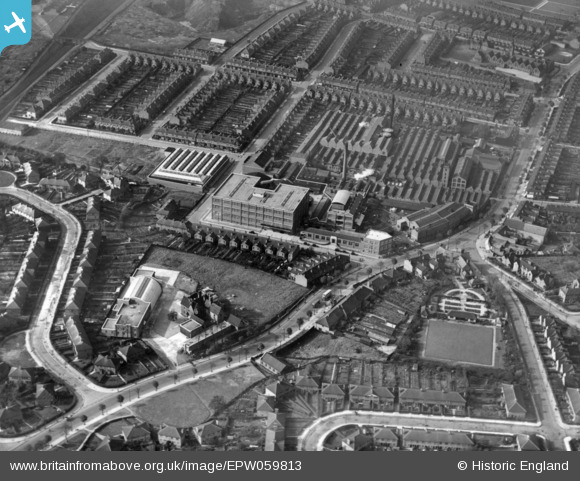
EPW059813 ENGLAND (1938). Southalls Charford Mills and environs, Birmingham, 1938. This image has been produced from a print.
© Copyright OpenStreetMap contributors and licensed by the OpenStreetMap Foundation. 2026. Cartography is licensed as CC BY-SA.
Nearby Images (4)
EPW059813

EPW059815

EPW058131

EPW035897

Details
| Title | [EPW059813] Southalls Charford Mills and environs, Birmingham, 1938. This image has been produced from a print. |
| Reference | EPW059813 |
| Date | 8-October-1938 |
| Link | |
| Place name | BIRMINGHAM |
| Parish | |
| District | |
| Country | ENGLAND |
| Easting / Northing | 411006, 287663 |
| Longitude / Latitude | -1.8379026032144, 52.486405358147 |
| National Grid Reference | SP110877 |
Pins

Griffin |
Saturday 24th of October 2015 07:51:44 PM | |
|
Griffin |
Saturday 24th of October 2015 07:51:02 PM | |
|
Griffin |
Saturday 24th of October 2015 07:36:13 PM | |
|
Griffin |
Saturday 24th of October 2015 07:35:00 PM |