
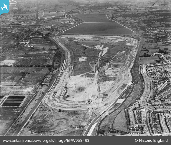
EPW058463 ENGLAND (1938). The Chingford (William Girling) Reservoir under construction, Edmonton, from the south, 1938
© Copyright OpenStreetMap contributors and licensed by the OpenStreetMap Foundation. 2026. Cartography is licensed as CC BY-SA.
Nearby Images (42)
EPW058463
 Reservoir under construction, Edmonton, from the south, 1938")
EPW056324

EPW056327

EPW052281

EPW056323

EPW055973

EPW055972

EPW056317

EPW055983

EAW040927

EPW060223
 Reservoir under construction, Edmonton, from the south, 1938")
EPW050863

EPW055970

EPW050862

EPW056824

EPW053847
 Reservoir under construction, Edmonton, 1937")
EPW060209
 Reservoir under construction, Edmonton, 1938")
EPW060627

EPW053838
 Reservoir under construction, Edmonton, 1937")
EPW056322

EPW056825

EPW056814

EPW058468
 Reservoir under construction, Edmonton, 1938")
EPW056318

EPW060634

EPW048912

EPW060636

EPW058460
 Reservoir under construction, Edmonton, 1938")
EPW052286

EPW050857

EPW049526

EPW055969

EAW040924

EPW052279

EPW050865

EPW055974

EPW056316

EPW058472
 Reservoir under construction, Edmonton, 1938")
EAW044489

EPW058458
 Reservoir under construction, Edmonton, 1938")
EPW060628

EPW056812

Details
| Title | [EPW058463] The Chingford (William Girling) Reservoir under construction, Edmonton, from the south, 1938 |
| Reference | EPW058463 |
| Date | 3-August-1938 |
| Link | |
| Place name | EDMONTON |
| Parish | |
| District | |
| Country | ENGLAND |
| Easting / Northing | 536422, 193447 |
| Longitude / Latitude | -0.029046645226159, 51.622815679643 |
| National Grid Reference | TQ364934 |
Pins
Be the first to add a comment to this image!