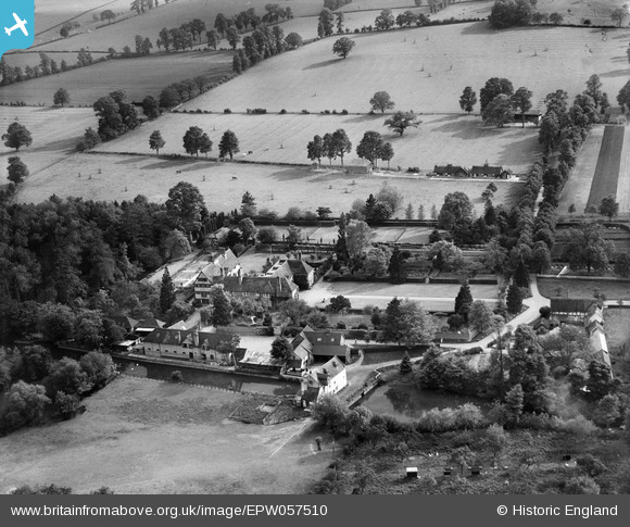
EPW057510 ENGLAND (1938). Clifford Manor, Clifford Chambers, 1938
© Copyright OpenStreetMap contributors and licensed by the OpenStreetMap Foundation. 2025. Cartography is licensed as CC BY-SA.
Nearby Images (7)
Details
| Title | [EPW057510] Clifford Manor, Clifford Chambers, 1938 |
| Reference | EPW057510 |
| Date | 9-June-1938 |
| Link | |
| Place name | CLIFFORD CHAMBERS |
| Parish | CLIFFORD CHAMBERS AND MILCOTE |
| District | |
| Country | ENGLAND |
| Easting / Northing | 419907, 251919 |
| Longitude / Latitude | -1.7089260611829, 52.164774327304 |
| National Grid Reference | SP199519 |
Pins

totoro |
Thursday 1st of August 2013 09:35:43 PM | |

totoro |
Thursday 1st of August 2013 09:35:05 PM |


![[EPW057510] Clifford Manor, Clifford Chambers, 1938](http://britainfromabove.org.uk/sites/all/libraries/aerofilms-images/public/100x100/EPW/057/EPW057510.jpg)
![[EPW057504] Clifford Manor, Clifford Chambers, 1938](http://britainfromabove.org.uk/sites/all/libraries/aerofilms-images/public/100x100/EPW/057/EPW057504.jpg)
![[EPW057509] Clifford Manor, Clifford Chambers, 1938](http://britainfromabove.org.uk/sites/all/libraries/aerofilms-images/public/100x100/EPW/057/EPW057509.jpg)
![[EPW057505] Clifford Manor, Clifford Chambers, 1938](http://britainfromabove.org.uk/sites/all/libraries/aerofilms-images/public/100x100/EPW/057/EPW057505.jpg)
![[EPW057506] Clifford Manor, Clifford Chambers, from the west, 1938](http://britainfromabove.org.uk/sites/all/libraries/aerofilms-images/public/100x100/EPW/057/EPW057506.jpg)
![[EPW057508] Clifford Manor, Clifford Chambers, 1938](http://britainfromabove.org.uk/sites/all/libraries/aerofilms-images/public/100x100/EPW/057/EPW057508.jpg)
![[EPW057507] St Helen's Church and the village, Clifford Chambers, from the south, 1938](http://britainfromabove.org.uk/sites/all/libraries/aerofilms-images/public/100x100/EPW/057/EPW057507.jpg)