
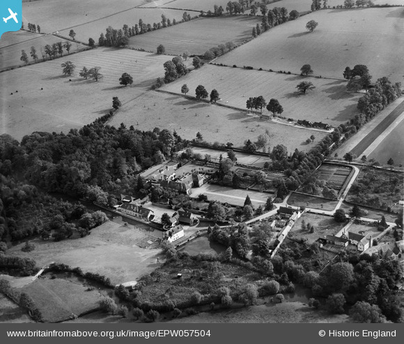
EPW057504 ENGLAND (1938). Clifford Manor, Clifford Chambers, 1938
© Copyright OpenStreetMap contributors and licensed by the OpenStreetMap Foundation. 2025. Cartography is licensed as CC BY-SA.
Nearby Images (7)
EPW057504

EPW057510

EPW057509

EPW057505

EPW057508

EPW057506

EPW057507

Details
| Title | [EPW057504] Clifford Manor, Clifford Chambers, 1938 |
| Reference | EPW057504 |
| Date | 9-June-1938 |
| Link | |
| Place name | CLIFFORD CHAMBERS |
| Parish | CLIFFORD CHAMBERS AND MILCOTE |
| District | |
| Country | ENGLAND |
| Easting / Northing | 419912, 251913 |
| Longitude / Latitude | -1.7088533058455, 52.164720198669 |
| National Grid Reference | SP199519 |
Pins

totoro |
Thursday 1st of August 2013 09:32:29 PM | |
|
totoro |
Thursday 1st of August 2013 09:30:28 PM | |
|
totoro |
Thursday 1st of August 2013 09:29:26 PM |