
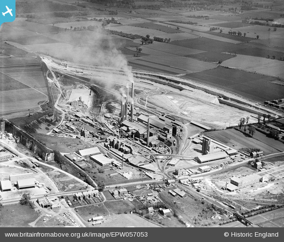
EPW057053 ENGLAND (1938). The Tunnel Portland Cement Works, West Thurrock, 1938
© Copyright OpenStreetMap contributors and licensed by the OpenStreetMap Foundation. 2026. Cartography is licensed as CC BY-SA.
Nearby Images (34)
EPW057053

EPW057043

EPW057054

EPW057046

EPW057048

EPW057052

EPW046468

EPW057050

EPW046467

EPW039473

EPW057055

EPW046469

EPW057047

EPW039470

EPW057049

EPW046462

EPW046466

EPW046470

EPW057044

EPW026639

EPW032826

EPW039474

EPW032825

EPW026644

EPW026640

EPW039471

EPW039476

EPW057045

EPW039475

EPW046464

EPW039472

EPW046465

EPW057051

EPW046463

Details
| Title | [EPW057053] The Tunnel Portland Cement Works, West Thurrock, 1938 |
| Reference | EPW057053 |
| Date | 12-May-1938 |
| Link | |
| Place name | WEST THURROCK |
| Parish | |
| District | |
| Country | ENGLAND |
| Easting / Northing | 557745, 177999 |
| Longitude / Latitude | 0.27184484279812, 51.478437095903 |
| National Grid Reference | TQ577780 |
Pins

Dylan Moore |
Saturday 15th of June 2013 03:07:58 PM | |
|
Dylan Moore |
Saturday 15th of June 2013 03:07:34 PM | |
|
Dylan Moore |
Saturday 15th of June 2013 03:06:55 PM | |
|
Dylan Moore |
Saturday 15th of June 2013 03:06:26 PM | |
|
Dylan Moore |
Saturday 15th of June 2013 03:05:57 PM | |
|
Dylan Moore |
Saturday 15th of June 2013 03:05:32 PM |