
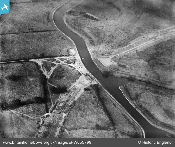
EPW055798 ENGLAND (1937). Construction of Raynesway (Town Planning Road No 4) at the River Derwent crossing, Alvaston, 1937
© Copyright OpenStreetMap contributors and licensed by the OpenStreetMap Foundation. 2026. Cartography is licensed as CC BY-SA.
Nearby Images (4)
EPW055798
 at the River Derwent crossing, Alvaston, 1937")
EPW060259

EPW060260
 crossing fields to the south of the River Derwent, Alvaston, 1938")
EPW055797
 by the River Derwent crossing, Alvaston, 1937")
Details
| Title | [EPW055798] Construction of Raynesway (Town Planning Road No 4) at the River Derwent crossing, Alvaston, 1937 |
| Reference | EPW055798 |
| Date | 12-October-1937 |
| Link | |
| Place name | ALVASTON |
| Parish | |
| District | |
| Country | ENGLAND |
| Easting / Northing | 438384, 334287 |
| Longitude / Latitude | -1.4292498880674, 52.904326831979 |
| National Grid Reference | SK384343 |
Pins
Be the first to add a comment to this image!