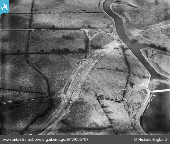
EPW055797 ENGLAND (1937). Construction of Raynesway (Town Planning Road No 4) by the River Derwent crossing, Alvaston, 1937
© Copyright OpenStreetMap contributors and licensed by the OpenStreetMap Foundation. 2026. Cartography is licensed as CC BY-SA.
Details
| Title | [EPW055797] Construction of Raynesway (Town Planning Road No 4) by the River Derwent crossing, Alvaston, 1937 |
| Reference | EPW055797 |
| Date | 12-October-1937 |
| Link | |
| Place name | ALVASTON |
| Parish | |
| District | |
| Country | ENGLAND |
| Easting / Northing | 438505, 334058 |
| Longitude / Latitude | -1.4274779174663, 52.902259484538 |
| National Grid Reference | SK385341 |
Pins

Peter Kazmierczak |
Saturday 5th of October 2013 02:29:00 PM |


![[EPW055797] Construction of Raynesway (Town Planning Road No 4) by the River Derwent crossing, Alvaston, 1937](http://britainfromabove.org.uk/sites/all/libraries/aerofilms-images/public/100x100/EPW/055/EPW055797.jpg)
![[EPW060260] The A5111 (Raynesway) crossing fields to the south of the River Derwent, Alvaston, 1938](http://britainfromabove.org.uk/sites/all/libraries/aerofilms-images/public/100x100/EPW/060/EPW060260.jpg)
![[EPW060252] The A5111 (Raynesway) crossing fields to the south of the River Derwent, Alvaston, 1938](http://britainfromabove.org.uk/sites/all/libraries/aerofilms-images/public/100x100/EPW/060/EPW060252.jpg)
![[EPW055798] Construction of Raynesway (Town Planning Road No 4) at the River Derwent crossing, Alvaston, 1937](http://britainfromabove.org.uk/sites/all/libraries/aerofilms-images/public/100x100/EPW/055/EPW055798.jpg)