
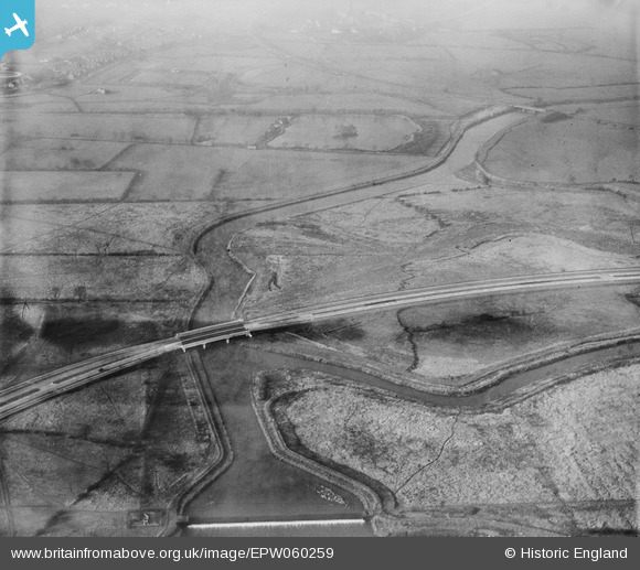
EPW060259 ENGLAND (1938). The A5111 (Raynesway crossing fields and the River Derwent, Spondon, 1938
© Copyright OpenStreetMap contributors and licensed by the OpenStreetMap Foundation. 2026. Cartography is licensed as CC BY-SA.
Nearby Images (3)
EPW060259

EPW060253
 crossing fields around the River Derwent, Spondon, 1938")
EPW055798
 at the River Derwent crossing, Alvaston, 1937")
Details
| Title | [EPW060259] The A5111 (Raynesway crossing fields and the River Derwent, Spondon, 1938 |
| Reference | EPW060259 |
| Date | 1-December-1938 |
| Link | |
| Place name | SPONDON |
| Parish | |
| District | |
| Country | ENGLAND |
| Easting / Northing | 438314, 334490 |
| Longitude / Latitude | -1.430266754671, 52.906156780697 |
| National Grid Reference | SK383345 |
Pins
Be the first to add a comment to this image!