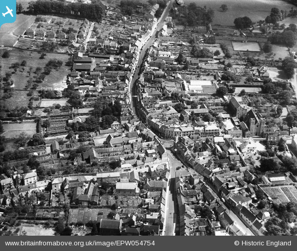
EPW054754 ENGLAND (1937). The Market Place and High Street, Wincanton, 1937
© Copyright OpenStreetMap contributors and licensed by the OpenStreetMap Foundation. 2026. Cartography is licensed as CC BY-SA.
Nearby Images (9)
Details
| Title | [EPW054754] The Market Place and High Street, Wincanton, 1937 |
| Reference | EPW054754 |
| Date | August-1937 |
| Link | |
| Place name | WINCANTON |
| Parish | WINCANTON |
| District | |
| Country | ENGLAND |
| Easting / Northing | 371326, 128645 |
| Longitude / Latitude | -2.4091702460093, 51.05589586085 |
| National Grid Reference | ST713286 |
Pins
Be the first to add a comment to this image!


![[EPW054754] The Market Place and High Street, Wincanton, 1937](http://britainfromabove.org.uk/sites/all/libraries/aerofilms-images/public/100x100/EPW/054/EPW054754.jpg)
![[EPW033739] The Market Place and High Street, Wincanton, 1930](http://britainfromabove.org.uk/sites/all/libraries/aerofilms-images/public/100x100/EPW/033/EPW033739.jpg)
![[EPW054755] The town, Wincanton, 1937](http://britainfromabove.org.uk/sites/all/libraries/aerofilms-images/public/100x100/EPW/054/EPW054755.jpg)
![[EPW033738] St Peter and St Paul's Church, Church Street and the town, Wincanton, 1930](http://britainfromabove.org.uk/sites/all/libraries/aerofilms-images/public/100x100/EPW/033/EPW033738.jpg)
![[EAW051926] The Market Place and the High Street, Wincanton, 1953. This image was marked by Aerofilms Ltd for photo editing.](http://britainfromabove.org.uk/sites/all/libraries/aerofilms-images/public/100x100/EAW/051/EAW051926.jpg)
![[EPW033735] The Cow and Gate Factory and the town, Wincanton, 1930](http://britainfromabove.org.uk/sites/all/libraries/aerofilms-images/public/100x100/EPW/033/EPW033735.jpg)
![[EAW051925] The High Street, Wincanton, 1953. This image was marked by Aerofilms Ltd for photo editing.](http://britainfromabove.org.uk/sites/all/libraries/aerofilms-images/public/100x100/EAW/051/EAW051925.jpg)
![[EPW033736] The Somerset & Dorset Joint Railway and the town, Wincanton, 1930](http://britainfromabove.org.uk/sites/all/libraries/aerofilms-images/public/100x100/EPW/033/EPW033736.jpg)
![[EPW033737] The town and surrounding countryside, Wincanton, 1930](http://britainfromabove.org.uk/sites/all/libraries/aerofilms-images/public/100x100/EPW/033/EPW033737.jpg)