
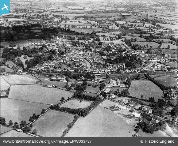
EPW033737 ENGLAND (1930). The town and surrounding countryside, Wincanton, 1930
© Copyright OpenStreetMap contributors and licensed by the OpenStreetMap Foundation. 2026. Cartography is licensed as CC BY-SA.
Nearby Images (8)
EPW033737

EPW033736

EPW033738

EPW054755

EPW033739

EPW054754

EPW033735

EPW054756

Details
| Title | [EPW033737] The town and surrounding countryside, Wincanton, 1930 |
| Reference | EPW033737 |
| Date | July-1930 |
| Link | |
| Place name | WINCANTON |
| Parish | WINCANTON |
| District | |
| Country | ENGLAND |
| Easting / Northing | 371113, 128605 |
| Longitude / Latitude | -2.4122064208545, 51.055525463636 |
| National Grid Reference | ST711286 |
Pins

SomersetChap |
Sunday 3rd of November 2024 08:54:58 AM | |
|
alastair wallace |
Saturday 12th of August 2023 11:23:41 AM | |
|
SomersetChap |
Friday 6th of May 2016 02:01:42 PM |