
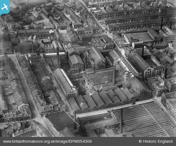
EPW054306 ENGLAND (1937). The Atlas Wool Combing Mills, Bradford, 1937
© Copyright OpenStreetMap contributors and licensed by the OpenStreetMap Foundation. 2026. Cartography is licensed as CC BY-SA.
Nearby Images (10)
EPW054306

EPW054303

EPW054301

EPW054302

EPW054298

EPW054300

EPW054304

EPW054299

EPW054305

EAW030797

Details
| Title | [EPW054306] The Atlas Wool Combing Mills, Bradford, 1937 |
| Reference | EPW054306 |
| Date | 14-July-1937 |
| Link | |
| Place name | BRADFORD |
| Parish | |
| District | |
| Country | ENGLAND |
| Easting / Northing | 415554, 432985 |
| Longitude / Latitude | -1.7638622045546, 53.792729698999 |
| National Grid Reference | SE156330 |
Pins

Paul McGowan |
Tuesday 9th of February 2016 12:24:34 PM |