
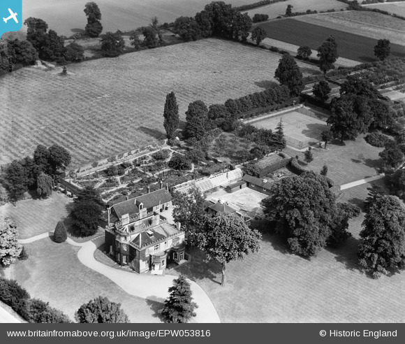
EPW053816 ENGLAND (1937). Harwood Hall and garden, Upminster, 1937
© Copyright OpenStreetMap contributors and licensed by the OpenStreetMap Foundation. 2026. Cartography is licensed as CC BY-SA.
Nearby Images (10)
EPW053816

EPW053817

EPW053818

EPW053815

EPW053824

EPW053820

EPW053822

EPW053819

EPW053823

EPW053821

Details
| Title | [EPW053816] Harwood Hall and garden, Upminster, 1937 |
| Reference | EPW053816 |
| Date | 26-June-1937 |
| Link | |
| Place name | UPMINSTER |
| Parish | |
| District | |
| Country | ENGLAND |
| Easting / Northing | 556088, 184836 |
| Longitude / Latitude | 0.25102760038632, 51.54033104341 |
| National Grid Reference | TQ561848 |
Pins
Be the first to add a comment to this image!