
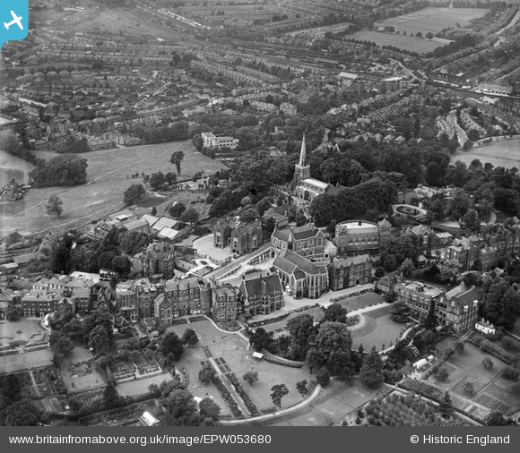
EPW053680 ENGLAND (1937). Harrow School, St Mary's Church and environs, Harrow on the Hill, from the south-east, 1937
© Copyright OpenStreetMap contributors and licensed by the OpenStreetMap Foundation. 2026. Cartography is licensed as CC BY-SA.
Nearby Images (24)
EPW053680

EAW042768

EPW018764

EPW000466

EAW014885

EPW000462

EPW006295

EPW000461

EAW042772

EPW000463

EAW042767

EAW042771

EAW014888

EAW042770

EPW000467

EPW005357

EPW025547

EPW005356

EAW014887

EAW042769

EAW024232

EPW006290

EPW000469

EAW014886

Details
| Title | [EPW053680] Harrow School, St Mary's Church and environs, Harrow on the Hill, from the south-east, 1937 |
| Reference | EPW053680 |
| Date | 12-June-1937 |
| Link | |
| Place name | HARROW ON THE HILL |
| Parish | |
| District | |
| Country | ENGLAND |
| Easting / Northing | 515380, 187302 |
| Longitude / Latitude | -0.33492096820905, 51.572289748462 |
| National Grid Reference | TQ154873 |


