
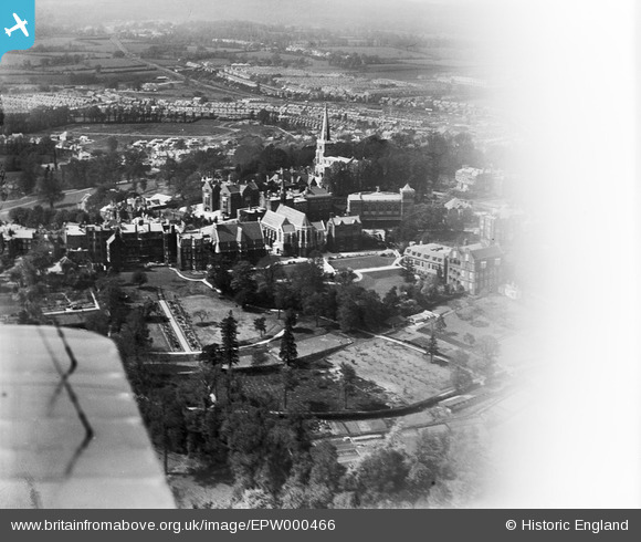
EPW000466 ENGLAND (1920). Harrow School, Harrow on the Hill, from the south-east, 1920
© Copyright OpenStreetMap contributors and licensed by the OpenStreetMap Foundation. 2026. Cartography is licensed as CC BY-SA.
Nearby Images (23)
EPW000466

EPW053680

EPW018764

EAW042768

EPW000461

EAW014885

EPW006295

EAW042772

EPW000462

EAW042767

EPW000463

EAW014887

EAW042770

EAW014888

EAW042771

EPW000467

EAW014886

EPW005357

EPW005356

EPW025547

EAW042769

EPW006290

EAW024232

Details
| Title | [EPW000466] Harrow School, Harrow on the Hill, from the south-east, 1920 |
| Reference | EPW000466 |
| Date | April-1920 |
| Link | |
| Place name | HARROW ON THE HILL |
| Parish | |
| District | |
| Country | ENGLAND |
| Easting / Northing | 515441, 187264 |
| Longitude / Latitude | -0.33405355073284, 51.571935692317 |
| National Grid Reference | TQ154873 |
Pins
Be the first to add a comment to this image!