
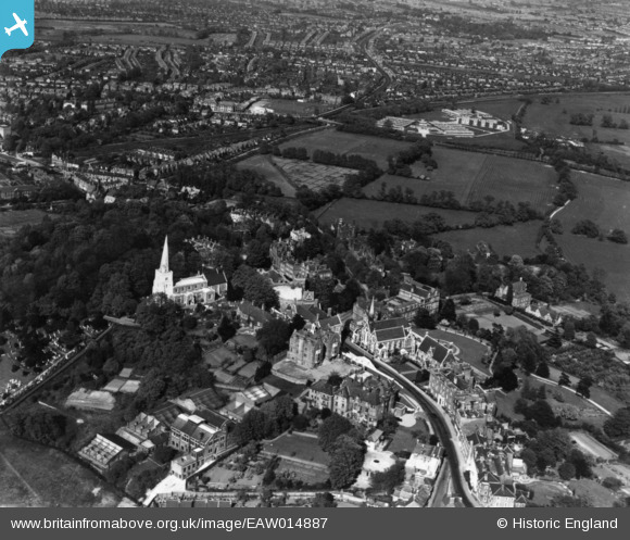
EAW014887 ENGLAND (1948). St Mary's Church, Harrow School and environs, Harrow on the Hill, 1948. This image has been produced from a print.
© Copyright OpenStreetMap contributors and licensed by the OpenStreetMap Foundation. 2026. Cartography is licensed as CC BY-SA.
Nearby Images (22)
EAW014887

EAW042767

EAW014885

EPW006295

EAW042772

EPW018764

EAW042770

EAW042769

EAW014888

EPW005356

EPW005357

EAW042771

EAW014886

EPW000463

EPW053680

EPW000462

EPW006290

EPW000466

EAW042768

EPW025547

EPW000467

EPW000461

Details
| Title | [EAW014887] St Mary's Church, Harrow School and environs, Harrow on the Hill, 1948. This image has been produced from a print. |
| Reference | EAW014887 |
| Date | 27-April-1948 |
| Link | |
| Place name | HARROW ON THE HILL |
| Parish | |
| District | |
| Country | ENGLAND |
| Easting / Northing | 515455, 187446 |
| Longitude / Latitude | -0.33379178104874, 51.573568748231 |
| National Grid Reference | TQ155874 |
Pins

The Laird |
Monday 16th of April 2018 01:31:20 AM | |
|
The Laird |
Monday 2nd of April 2018 07:46:07 PM |