
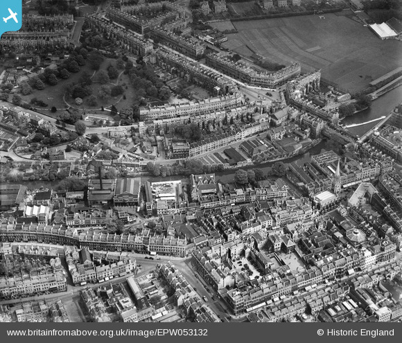
EPW053132 ENGLAND (1937). Henrietta Park and the city centre, Bath, 1937
© Copyright OpenStreetMap contributors and licensed by the OpenStreetMap Foundation. 2026. Cartography is licensed as CC BY-SA.
Nearby Images (19)
EPW053132

EPW053135

EPW053131

EPW053136

EPW053129

EPW053128

EPW053127

EPW053130

EPW053133

EPW053138

EPW053134

EPW001958

EAW000752

EPW053137

EAW000753

EAW000750

EPW048402

EAW049901

EPW033152

Details
| Title | [EPW053132] Henrietta Park and the city centre, Bath, 1937 |
| Reference | EPW053132 |
| Date | 19-May-1937 |
| Link | |
| Place name | BATH |
| Parish | |
| District | |
| Country | ENGLAND |
| Easting / Northing | 375171, 165129 |
| Longitude / Latitude | -2.35683192498, 51.384167054489 |
| National Grid Reference | ST752651 |
Pins
Be the first to add a comment to this image!