
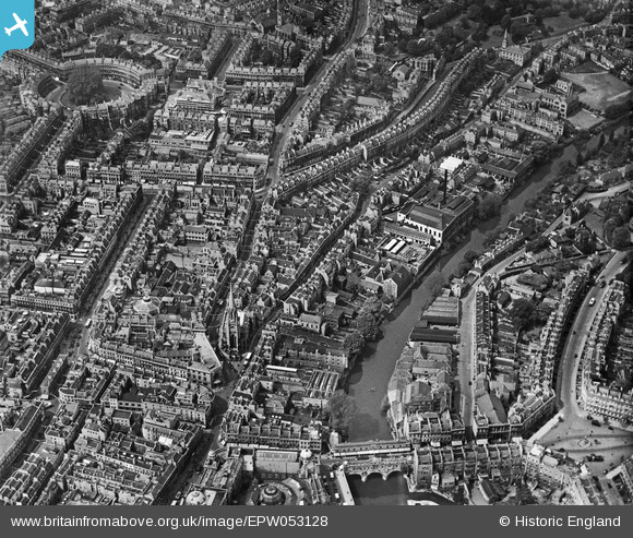
EPW053128 ENGLAND (1937). Pulteney Bridge, St Michael's Church and environs, Bath, 1937
© Copyright OpenStreetMap contributors and licensed by the OpenStreetMap Foundation. 2026. Cartography is licensed as CC BY-SA.
Nearby Images (18)
EPW053128

EPW053127

EPW053133

EPW053129

EPW053130

EPW053134

EPW053135

EPW053131

EPW053138

EPW053132

EPW053136

EPW001958

EPW053137

EPR000133

EPW033152

EPW033154

EPW048393

EPR000129

Details
| Title | [EPW053128] Pulteney Bridge, St Michael's Church and environs, Bath, 1937 |
| Reference | EPW053128 |
| Date | 19-May-1937 |
| Link | |
| Place name | BATH |
| Parish | |
| District | |
| Country | ENGLAND |
| Easting / Northing | 375064, 165137 |
| Longitude / Latitude | -2.3583702135248, 51.384234302208 |
| National Grid Reference | ST751651 |
Pins
Be the first to add a comment to this image!