
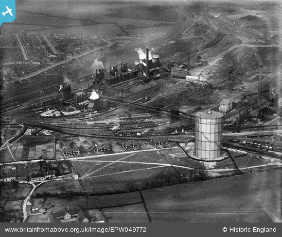
EPW049772 ENGLAND (1936). The Iron and Steel Works, Corby, 1936
© Copyright OpenStreetMap contributors and licensed by the OpenStreetMap Foundation. 2026. Cartography is licensed as CC BY-SA.
Nearby Images (19)
EPW049772

EAW034120

EAW034121

EAW034117

EAW034113

EPW049771

EAW034118

EPW054913

EAW034119

EAW034115

EAW034116

EAW034123

EPW049774

EPW054912

EPW049775

EPW054923

EAW034114

EAW045576

EPW049770

Details
| Title | [EPW049772] The Iron and Steel Works, Corby, 1936 |
| Reference | EPW049772 |
| Date | March-1936 |
| Link | |
| Place name | CORBY |
| Parish | |
| District | |
| Country | ENGLAND |
| Easting / Northing | 489717, 289379 |
| Longitude / Latitude | -0.67836533807108, 52.494564023434 |
| National Grid Reference | SP897894 |
Pins
Tegels |
Thursday 6th of April 2017 10:48:30 PM |