
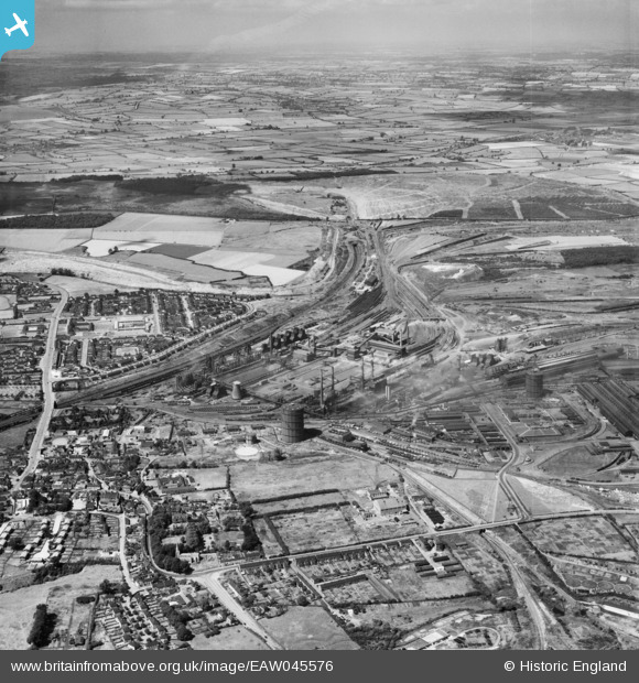
EAW045576 ENGLAND (1952). The Corby Steelworks and environs, Corby, from the south, 1952
© Copyright OpenStreetMap contributors and licensed by the OpenStreetMap Foundation. 2026. Cartography is licensed as CC BY-SA.
Nearby Images (9)
EAW045576

EPW049771

EAW034115

EAW034113

EAW045559

EAW034120

EAW034119

EPW054913

EPW049772

Details
| Title | [EAW045576] The Corby Steelworks and environs, Corby, from the south, 1952 |
| Reference | EAW045576 |
| Date | 19-July-1952 |
| Link | |
| Place name | CORBY |
| Parish | |
| District | |
| Country | ENGLAND |
| Easting / Northing | 489918, 289206 |
| Longitude / Latitude | -0.67545196718664, 52.492975895194 |
| National Grid Reference | SP899892 |
Pins
Be the first to add a comment to this image!