
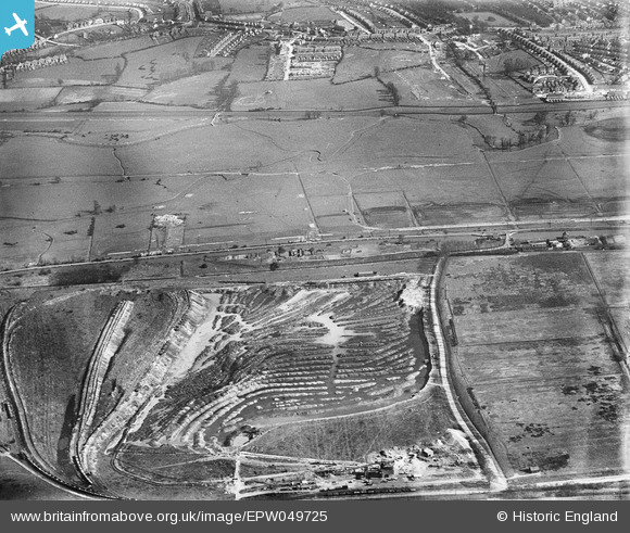
EPW049725 ENGLAND (1936). Aggregates extraction to the north of the Edmonton Urban District Council Sewage Farm, Edmonton, 1936
© Copyright OpenStreetMap contributors and licensed by the OpenStreetMap Foundation. 2026. Cartography is licensed as CC BY-SA.
Nearby Images (9)
EPW049725

EAW040969

EPW049700

EPW048910

EPW049525

EPW050868

EPW048911

EPW060640

EPW060643

Details
| Title | [EPW049725] Aggregates extraction to the north of the Edmonton Urban District Council Sewage Farm, Edmonton, 1936 |
| Reference | EPW049725 |
| Date | March-1936 |
| Link | |
| Place name | EDMONTON |
| Parish | |
| District | |
| Country | ENGLAND |
| Easting / Northing | 536318, 193987 |
| Longitude / Latitude | -0.030338018785744, 51.627693863288 |
| National Grid Reference | TQ363940 |
Pins
Be the first to add a comment to this image!